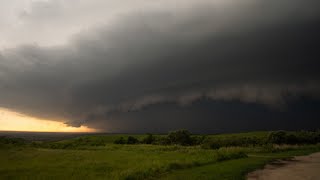
Severe Thunderstorm Damaging 60+ mph Winds Chatham NY September 7th 2023
On Thursday September 7th, 2023, the SPC placed most of eastern NY under a Slight Risk of Severe Weather. As a cold front approached at the surface, dewpoints near 70 degrees and diurnal surface heating resulted in moderate levels of instability. Additionally, a tightening horizontal temperature gradient occurred as a weak upperlevel trough interacted with a blocking ridge off the east coast. This produced a modest 30 to 35 kt southwesterly midlevel jet.
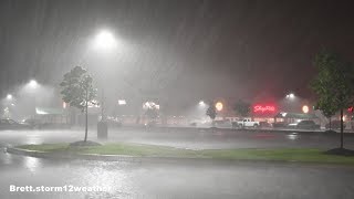
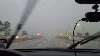
While these conditions are sufficient to produce severe weather, the evening squall line that impacted much of the mid and upper Hudson valley was far more intense than I expected. While multiple variables were undoubted at play, it appears that midlevel dry air and steep lowlevel lapse rates helped to produce greater downdraft accelerations. This dry air helped to increase the negative buoyancy of raincooled downdrafts within the line and funneled intense winds to the surface. The line even developed a substantial rear inflow jet as it moved through the region, allowing it to enhance the midlevel wind field before pulling it down to the surface. The result was several minutes of damaging winds exceeding 60 mph in gusts.
Several Mesonet stations recorded wind gusts of 60 mph or slightly higher within 20 miles of my filming location. The town of Chatham where I intercepted this line, received widespread tree damage with power outages across the region. I returned prior to a storm chase the following afternoon to document some of the damage. The power company had already restored many areas and much of the downed trees had been cleared from the roadways.