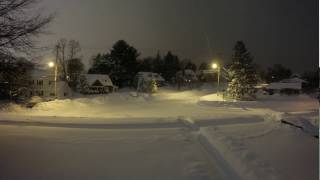
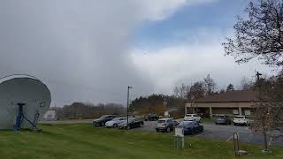
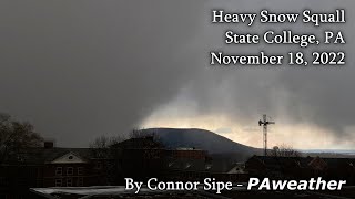
Snow Microburst - State College PA 2-19-22
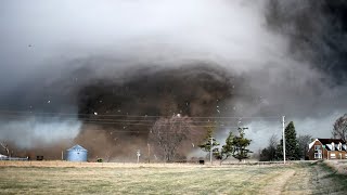
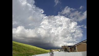
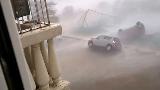
Finally uploading this insane snow squall from PSU last year! We went to the top of the west deck parking garage to get a better view. I've never seen such a defined wall of snow on the leading edge of a squall before! Looking back at the footage, we all believe this was a cold convection microburst. You can see very clearly at 0:48 that the snow is fanning out both right and left, and there is a bulge in the center where the snow is approaching faster than to the sides of it. Doppler velocity also depicted an area of enhanced wind near our location. It's an extremely fascinating case!
Here are some stats for the squall:
Temperatures dropped from 33F just before the squall to 25F during it (recorded on my Kestrel).
The Walker building recorded a 35 mph sustained wind and gusted to 45 mph.
Only ~20 minutes passed from the moment the snow wall hit, to when the sun came out again.
I hope I get to experience another snow squall like this again sometime. It was really fun!!
Contacts:
Twitter: / stormin13norman
Twitch: / storminorman_
Email: [email protected]
To explain why I think this was a microburst:
Theoretically, you can have a microburst in ANY convection, even within snow squalls! There is a real case for this being a weak microburst, as you can see the classic "spreading out" motion well at 0:57 onward (and a "bowing" shape to the wall of snow at 2:50), depicting an area of locally larger negative buoyancy (sinking air). The air within a microburst is colder than the surrounding environment, and I measured an 8°F temperature drop in a matter of minutes, right around when the 45mph wind gust occurred. Getting more technical, ERA5 reanalysis soundings suggest DCAPE was on the order of 46 J/kg, and while that isn't nearly as large of a value as you’d see in a summer thunderstorm, it is not zero; large enough for instances of locally intense downdrafts, aka microbursts. DownT also suggests this was a microburst. "DownT is an estimate of the surface temperature within the core of a saturated downdraft." It was estimated to be 27F in the reanalysis sounding, and I recorded 25F in the core of the snow squall!
Here's a great time lapse of the squall that my friend Sam took (who's also in this video): • Microburst from Severe Snow Squalls i...