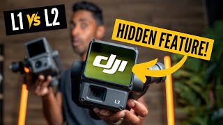
Is the DJI Zenmuse L2 LiDAR worth buying? (L2 vs R3 Pro V2)

Dive into my comprehensive comparison of DJI's L2 and ROCK Robotic’s R3 Pro V2 LiDAR mapping systems as I test their abilities in an urban landscape. This video covers their technical specifications, flight plans, and realworld performance for professional mapping and 3D modeling.
https://www.rockrobotic.com/r3prov2
https://enterprise.dji.com/zenmusel2
Watch as I examine data accuracy, range, and detailed point cloud analysis to help you decide which system takes the cake!
Video Timestamps:
00:00 Introduction & Overview
00:19 Mission Plan & Setup
01:30 InFlight Data Collection
05:32 Data Analysis Back at the Office
10:46 Point Cloud Comparison & Results
19:37 Optimizing & Smoothing Data
26:23 Conclusions & Final Thoughts
Key Highlights:
✅ Comparison of DJI L2 and R3 Pro V2 LiDAR systems
✅ Detailed look at mission planning and inflight parameters
✅ Analysis of accuracy and range capabilities
✅ Examination of point clouds and colorization differences
✅ Implications for urban mapping and 3D modeling
Subscribe for more reviews and tutorials, and hit the bell icon to stay updated! Drop a comment below with your questions or thoughts, and remember to like and share if you enjoyed this video!
#DJIL2 #R3ProV2 #LiDAR #LiDARComparison #Drone #DronePilot #Drones #UAV #LandSurveying #CivilEngineering #DJI #L2 #ROCKRobotic #3DMapping #landsurveyor #landsurveying #UrbanMapping #DroneTechnology #GeospatialAnalysis #geospatial #TechReview #Technology #PrecisionMapping #3Dmapping