What is a Curry Stool
Curry Stools, named after their resemblance to threelegged stools and the person who devised them: Ernest Curry / Cpl Ernie Curry, are an intriguing relic of the Ordnance Survey's efforts to map and survey remote areas. From 1936 through the 1960s, these concrete structures were strategically placed in marshy terrain where traditional trigonometric surveying methods faced challenges due to unstable ground.
The Ordnance Survey, tasked with mapping the landscapes of the United Kingdom with precision, encountered difficulties in establishing trigonometric points in certain regions characterized by marshlands. These areas posed significant obstacles for laying the foundations of traditional trig points. To overcome this challenge, the ingenious solution of Curry Stools was devised.
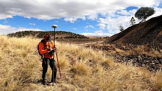
These threelegged concrete structures served as stable platforms upon which the theodolite, a precise surveying instrument, could be securely positioned. By providing a reliable and firm base in marshy terrain, Curry Stools enabled surveyors to conduct accurate measurements for mapping purposes. Their placement in remote and often inaccessible areas speaks to the dedication of surveying teams in ensuring comprehensive mapping coverage across the landscape.
Although the advent of modern surveying techniques and technology may have rendered Curry Stools obsolete, they remain as silent witnesses to the meticulous efforts of surveyors in overcoming geographical challenges. Today, encountering these curious structures while hiking through the hills offers a glimpse into the historical methods employed to chart the topography of the land.
There are still nine Curry Stools which can be visited. Below I have given the grid reference of each.
If you do pay them a visit don’t forget to give them a clean – even if it’s just using your boot to scuff off any vegetation. This way they will still be around for future generations.
Cellar Head Isle of Lewis. Grid Ref: NB 54777 55560
Cam Hill Shetland Isles. Grid Ref: HU 50015 92806
Ness of Copister Shetland Isles. Grid Ref: HU 49328 78758
Scotasay Island Western Isles. Grid Ref: NG 18515 97437
Killin Monadhlaith Mountains. Grid Ref: NH 51250 09333
Rubh Aird na Sgitheich – Jura. Grid Ref: NR 47722 79025
Herdship Fell – Pennines. Grid Ref: NY 80020 32521
Iron Band – Pennines. Grid Ref: NY 83405 18653
Bink Moss – Pennines. Grid Ref: NY 87665 24217
Here is the link to the YouTube video explaining how Trig Points actually work.
• How do trig points actually work?