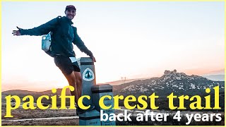
The Wildest Thru Hike in North America - Great Divide Trail ep1

Spanning 1,200km (or 750mi) across the Canadian Rocky Mountains, the Great Divide Trail is one of the most premier long distance hiking trails in the entire world. Following the divide very closely between Alberta and British Columbia, along the mountain range crest. They call this hike the wildest thru hike for a reason, it's extremely remote, and the conditions are truly challenging given the high elevation and extreme landscape. Similar to how the Continental Divide Trail was 10 or so years ago, the GDT is a collection of existing trails, strung together with cross country and off trail sections to make one long footpath.
My guide on how to hike the GDT (picturies, stats, gear, and info!)
https://jupiterhikes.com/2023/11/15/h...
My top gear picks for the GDT:
Patagonia Rain Jacket https://bit.ly/3ua4k7H
Ursack Major XL Food Bag https://amzn.to/47nbfIM
Mosquito Head Net https://amzn.to/46bpiAv
Satellite Communicator https://amzn.to/3SFnxbt
Our Full Gear Lists for the GDT: http://www.jupiterhikes.com/gear/
Become a member of the GDTA to help grow this amazing trail!
https://greatdividetrail.com/getinvo...
The Great Divide Trail at a glance:
1,200km (750mi) in length, depending on end point
Grizzly and moose country the entire way
5 National Parks (Banff, Jasper, Kootenay, Waterton, and Yoho)
9 Provincial Parks, 4 Wilderness Areas, 4 Forest Districts
2,590m (or 8,500ft) is the high point @ an unnamed pass in Section E
1,055m (or 3,500ft) is the low point @ Old Fort Point outside of Jasper
Peak hiking season is from July to September,
30 to 60 days is roughly how long this hike takes depending on experience and fitness
Overall the GDT is one of the most amazing thru hikes you could ever do. Unparalleled scenery, glaciers around every corner, grizzly bears, moose, pika, marmots, exposed alpine meadows and lakes. Ridge walks on loose scree and talus. Off trail travel, bushwhacking, and adventure. Hiking through popular national parks such as Banff and Jasper. It truly is an incredible beast of a hike.
Most of the time there are no markings to let you know where to go, so basic map reading and navigation skills are necessary. You will almost never have cell service, even when in a 'town'. The trail varies greatly from old forest road, national park perfect trail, bushy and overgrown, or completely nonexistent. I would say that this is a pretty harsh first thru hike to do but then again, if you're going to do only one, you might as well do the best one right? This is a true adventure, and no hiker willing to plan and prepare for it would be disappointed.
The GDT starts in Waterton Lakes National Park, which is directly north of Montana and Glacier National Park on the US and Canadian border. If you're American and have ever done hiking in Glacier just imagine doing that for 68 weeks, and you have the GDT. The southern terminus is actually shared by the CDT, so conceivably one could start a hike at the Mexican border, walk the Continental Divide Trail across the US, then continue on the GDT even further north into Canada for a monster 3,500 mile hike. This has been done a couple times before. It is a special thing to stand at the CDT monument but to be going in a different direction. Just knowing those other trails also begin or end there is really cool and adds to the feeling.
The first big challenge being the La Coulotte Ridge and Barnaby Ridge alternate, which are both physically demanding, and also waterless stretches. It is about 150km from the start to your first town of Coleman/Blairmore, which is the end of section A. The trail is split into seven sections, and this video shows both A and B. While the final two sections (F & G) are the hardest.
The second section follows the newly built High Rock Trail. From Coleman and Crowsnest Pass it is 200km to the next town at Peter Lougheed Provincial Park. An extremely long section without resupply, should something go wrong. Unfortunately for us Sprocket go shin splints, and we both came down with a cold! So section B turned into quite the slog.
The big challenge in section B is the length, and how much food you must carry. We planned 7 days, but many take as much as 10. There are two major passes, tornado saddle, and Fording River Pass. Both you would hope to have good weather for, but overall it is the length of this resupply that is the major difficulty.
Hiking Essentials Shirt! http://jupiterhikes.com/product/hikin...
If you would like to get access to content I create about this type of stuff I don't share anywhere else join me on my Patreon!
/ jupiterhikes
If you'd like more info about me, my hiking, or painting:
https://www.jupiterhikes.com
/ jupiterhikes
/ jupiterhikes