Terrain Amplification using Multi-scale Erosion

Siggraph 2024 Technical Papers
Authors
Hugo Schott (1), Eric Galin (2), Eric Guérin (1), Adrien Peytavie (2), Axel Paris (3)
(1) INSA Lyon, CNRS, LIRIS
(2) Université Claude Bernard Lyon 1, CNRS, LIRIS
(3) Adobe
Abstract
Modeling highresolution terrains is a perennial challenge in the creation
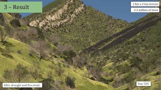
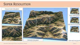
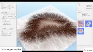
of virtual worlds. In this paper, we focus on the amplification of a lowresolution input terrain into a highresolution, hydrologically consistent terrain featuring complex patterns by a multiscale approach. Our framework combines the best of both worlds, relying on physicsinspired erosion models producing consistent erosion landmarks and introducing control at different scales, thus bridging the gap between physicsbased erosion simulations and multiscale procedural modeling. The method relies on a fast and accurate approximation of different simulations, including thermal, stream power erosion and deposition performed at different scales to obtain a range of effects. Our approach provides landscape designers with tools for amplifying mountain ranges and valleys with consistent details.


![[SIGGRAPH 2024] A Dynamic Duo of Finite Elements and Material Points](https://i.ytimg.com/vi/qSDfoOZwFpo/mqdefault.jpg)


![How Are Sedimentary Rocks Formed? [Weathering, Erosion, Deposition, Compaction, Cementation]](https://i.ytimg.com/vi/x0lauGbQWvQ/mqdefault.jpg)