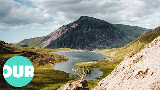
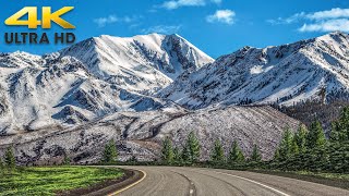
Snowdonia National Park 4K - Scenic Drive - Wales UK
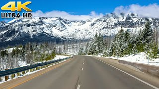
Morning drive at dawn to the most scenic mountain pass in Snowdonia National Park in Wales United Kingdom. Sheep, stone walls, small villages, quiet streams, and stunning scenic countryside views! Video begins in the small village of Penrhyndeudraeth, passes through Beddgelert, over PenyPass of Caernarfon, and ends in the village of Llanberis. Unlike National Parks in America, you will find many residents within National Parks throughout the UK (more than 26,000 people live within Snowdonia National Park).
Filmed in 4K60FPS HDR H.265 and 4K30FPS SDR H.264. This video is the H.265 version. Please let me know if the video plays correctly on your display!
Route: https://goo.gl/maps/w2i5tT6NCXMY2Q9e6 .
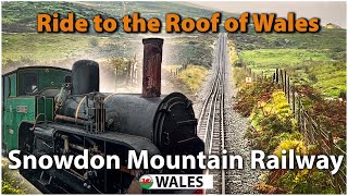
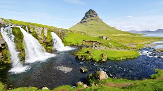
Snowdonia is a region in northwest Wales concentrated around the mountains and glacial landforms of massive Snowdonia National Park. The park's historic Snowdon Mountain Railway climbs to the summit of Wales's highest mountain, Mount Snowdon, offering views across the sea to Ireland. The park is also home to an extensive network of trails, over 100 lakes and craggy peaks like Cader Idris and Tryfan. ― Google
Snowdonia (Welsh: Eryri) is a mountainous region in northwestern Wales and a national park of 823 square miles (2,130 km2) in area. It was the first to be designated of the three national parks in Wales, in 1951.
Snowdonia National Park (Welsh: Parc Cenedlaethol Eryri) was established in 1951 as the third national park in Britain, following the Peak District and the Lake District. It covers 827 square miles (2,140 km2), and has 37 miles (60 km) of coastline. The Snowdonia National Park covers parts of the counties of Gwynedd and Conwy.
The park is governed by the Snowdonia National Park Authority, which is made up of local government and Welsh Government representatives, and its main offices are at Penrhyndeudraeth. Unlike national parks in other countries, Snowdonia (and other such parks in Britain) is made up of both public and private lands under central planning authority.
More than 26,000 people live within the park. 58.6% of the population could speak Welsh in 2011.
While most of the land is either open or mountainous land, there is a significant amount of agricultural activity within the park.
Since the local government reorganisation of 1998, the park lies partly in the county of Gwynedd, and partly in the county borough of Conwy. It is governed by the 18member Snowdonia National Park Authority; nine members are appointed by Gwynedd, 3 by Conwy, and the remaining six by the Welsh Government to represent the national interest. Unusually, Snowdonia National Park has a hole in the middle, around the town of Blaenau Ffestiniog, a slate quarrying centre. This was deliberately excluded from the park when it was set up to allow the development of new light industry to replace the reduced slate industry. (There is a similar situation in the Peak District National Park where the boundaries were drawn to exclude large builtup areas and industrial sites from the park with the town of Buxton and the adjacent quarries outside but surrounded on three sides by the park.) The Snowdonia Society is a registered charity formed in 1967. It is a voluntary group of people with an interest in the area and its protection.
Amory Lovins led the successful 1970s opposition to stop Rio Tinto digging up the area for a massive mine.
Climate
Snowdonia is one of the wettest parts of the United Kingdom; Crib Goch in Snowdonia is the wettest spot in the United Kingdom, with an average rainfall of 4,473 millimetres (176.1 in) a year over the 30year period prior to the mid2000s. (There is a rainfall gauge at 713 metres, 2340' on the slopes below Crib Goch.)
https://en.wikipedia.org/wiki/Snowdonia
![4K Scenic Drive to Furka Pass | Grimsel Pass to Andermatt, Switzerland [Remake]](https://i.ytimg.com/vi/hpeCvgjo9Bo/mqdefault.jpg)