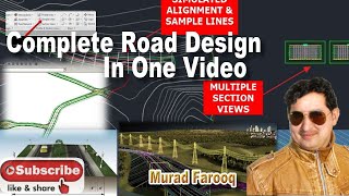
ROAD DESIGN TUTORIAL FROM START TO FINISH

connect with me via social
twitter @aprokosurveyor
instagram _
youtube
Hire me on fiver https://www.fiverr.com/s/aXK9kQ?utm_s...
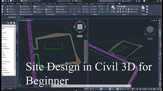
road design with civil 3d 2015
General Workflow
1. Create existing surface conditions. Road design typically begins by creating a surface for the existing conditions and which forms a baseline for further design and analysis of the new roadway; existing information about the topography, utilities, parcels and other potential impacts to the route design is also collected.
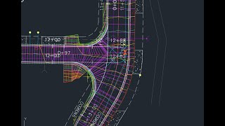
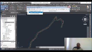
2. Design alignment. An alignment defines the main horizontal route that typically represents the construction baseline of the roadway. Alignments may be created using survey information collected from the field or from existing 2DCAD elements such as lines and polylines. Optionally, they may be created using the wide variety of alignment creation and layout tools.
3. Apply design criteria. Determine the proposed design and the design constraints that are to be placed on the alignment. This includes speed and superelevation parameters. Design criteria may be assigned at the onset of the alignment layout or at any time during the design process. Warning alerts will aid in the swift design of a conforming alignment.
4. Generate existing ground profile and design grades. Display existing ground surface data for the design alignment and create the finished grades. Finished grade profiles may be created graphically using profile creation tools, or generated from a best fit analysis of existing entities or from information from an external file.
5. Construct assemblies. Assemblies define the crosssectional component of the design and are built by connecting individual subassembly objects, thereby helping to simulate the geometry and material makeup of the road as well as helping to define how it interacts with surrounding features along the route. The subassemblies are selected from the prebuilt libraries contained in the Civil 3D Tool Palette. Custom subassemblies can also be created using the Subassembly Composer.
6. Build the corridor. Corridors are the resulting dynamic 3D model representation built from the combination of horizontal, vertical and crosssectional design elements.
7. Perform analysis of the resulting model. Corridors may be used to calculate earthworks and quantity takeoffs, to perform sight and visual analysis, to generate surfaces, and to extract information for construction purposes. Individual corridor sections may be examined and edited to help accommodate unique or localized design conditions.
8. Perform design optimization of the already analyzed model. To achieve a better design it may be necessary to adjust one or more of the corridor components. For example, you can adjust the design profile to better balance cut and fill volumes. Edits may be done using a variety of methods, such as grips, via tabular inputs, and with objectspecific editing commands.
Personally(user standard) i use the following workflow when performing road design in AutoCAD Civil 3D:
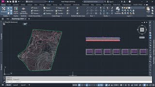
1. Import points.
2. Create existing ground surface.
3. Create the proposed alignment.
4. Modify proposed alignment.(Label properties and curves)
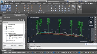
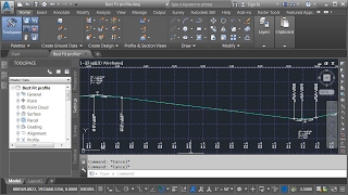
5. Create the proposed profile and add data bands.
6. Modify the proposed profile. ( Cut and fill volumes and design levels)
7. Create the proposed assembly.
8. Create corridor.
9. Create superelevation views.
10. Modify profile. ( Add superelevation data)
11. Create finished ground surfaces from the proposed alignment.
12.Create sample lines group.
13. Compute materials.
14. Create multiple section views.
this video was created by by my senior collegue At the department of geomatics ahmadu bello university zaria nigeria.. thank you sir abdul for allowing me to post your video on my channel.. the video has helped me thus far, i sure bet you it will help you more thank you very much pls dont forget to hit the subcribe button
#HowtoPlanforaSuccessfulRoadDesignProject
#HowtoDesignaRoad
#HowtodesignaroadfromstarttofinishinCivil3D
#HowtoPlanforaSuccessfulRoadDesignProject