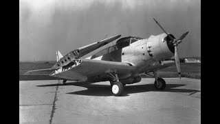
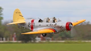
Preserving History - US Navy Douglas TBD-1 Devastator

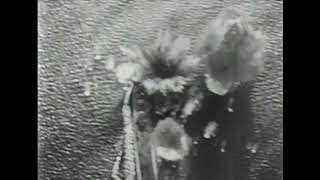
3D at Depth Inc., the world's leading expert in subsea LiDAR laser technology and 3D data solutions, has successfully integrating photogrammetry with Subsea laser LiDAR (SL) technology to create reverse engineered 3D models. The technique was developed during an October 2018 expedition with the Air/Sea Heritage Foundation to document the largely intact wreck of a rare and historically significant US Navy Douglas TBD1 Devastator aircraft resting at the bottom of Jaluit Lagoon in the Republic of the Marshall Islands (RMI).
Of the 129 Devastators built, all were either lost in battle, destroyed in operational accidents, or scrapped before the end of World War II. This particular expedition was developed to capture precise, repeatable, millimetric data to build an accurate 3D model as a 21st century site map for this significant cultural heritage asset; and to serve as a “predisturbance survey” for the proposed recovery, conservation and public exhibition of the historic plane at the National Museum of the United States Navy in Washington, DC.
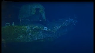
The plane, US Navy Bureau of Aeronautics Number (BuNo) 1515, formerly assigned to Torpedo Squadron Five (VT5) aboard the aircraft carrier USS Yorktown (CV5) with the fuselage code "5T6", is in a sensitive marine habitat. To conduct a safe, touchless, accurate survey, that would render a worldclass 3D model, the expedition brought together a group of leading experts and volunteers utilizing the most advanced technology available.
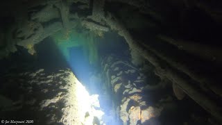
Over six days, dozens of dives were conducted to the wreck site located under 130 ft of water. 3D at Depth’s SL3 laser was deployed at varying ranges from the wreck site while maintaining a safe distance, so as not to disturb the surrounding area. The steerable laser beam allowed for flexibility and accuracy while working alongside other technology applications. The SL3 pulsed at 40,000 measurements/sec for each scan position acquiring very highdensity sector scans. 3D at Depth’s patented index of refraction correction algorithm was able to deliver repeatable data sets in low clarity water quality where other optical solutions would struggle to operate.
In total, the SL3 LiDAR laser delivered a total of 92 million points and the photogrammetric data after processing produced 5.7 million vertices. Each dense point cloud was then surfaced modeled and moved into a 3D design computer. Optical imagery from photogrammetry, 360 VR and stills were integrated into the designs to render an exact 3D model of the Devastator.
For more information visit our website www.3DatDepth.com


![[REUPLOAD] 5 Minute Guide to the TBD1 Devastator](https://i.ytimg.com/vi/8Q1nmPznfnQ/mqdefault.jpg)