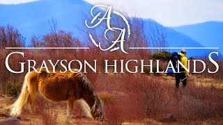
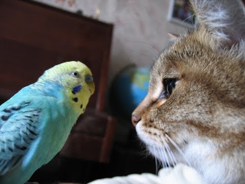
Hiking the Grayson Highlands - Solo Backpacking Trip
3 days of Solo Backpacking, Hiking, Hammock Camping, & Wild Ponies on the Appalachian Trail in Virginia's Grayson Highlands. GPS Data at http://wwww.sintax77.com
For this backpacking trip, I’ll be hiking and camping solo in a section of the Mt Rogers National Recreation Area, within the larger George Washington and Jefferson National Forest. I’ll be using a portion of the Appalachian Trail to create a 3 day, 2 night backpacking loop of around 20 miles or so.
The Grayson Highlands are known for their high winds and unpredictable, rapidly changing weather, so being that I’m doing the trip in March, I’ll be packing amount of warm weather and rain resistant gear. If you’re interested in a detailed account of everything that I packed, check
out my previous Winter Ultralight Backpacking Gear List blog post and video. That will give you a look at exactly what I packed for the trip.
Grayson Highlands Backpacking Trip Route Overview – Sintax77
Below is a daily rundown of the trails and campsites used for each day. For an easier read along with downloadable Full GPS track data, check out my full blog post here: http://wwww.sintax77.com/hikingtheg...
Parking Location:
Grayson Highlands State Park, Overnight Backpacker’s Parking Area at the Massie Gap Parking Lot. N36° 38.012′ W81° 30.322′
Trails Used, Day 1:
Depart Massie Gap Parking Lot
Rhododendron Trail
Appalachian Trail South
Wilburn Ridge Trail (it’s also possible to stay on the AT)
Rejoin the Appalachian Trail South
Setup camp about 200 yards past the Thomas Knob Shelter.
Day 1 Mileage: 4.25 miles
Day 1 Elevation Gain: 2,096′
A spring is about a 100 yards down the trail behind the shelter.
Camping options for tents and hammocks are available a few hundred yards past the shelter, heading south. Tenting spots are on the ridge to the left, hammock camping opportunities are in the trees to the right.
There are also some nice campsite opportunities about a 1/4 mile or so before the shelter as well (AT north from the shelter)
Trails Used, Day 2:
Continue on the Appalachian Trail South
Mt Rogers Trail Towards Grindstone Campground (not to be confused with the Mt
Rogers Spur Trail which hits the summit of Mt Rogers. That trail is available shortly after leaving the campsite. I’ve heard it doesn’t have any views, but it holds the distinction as Virginia’s
highest peak).
Lewis Fork Spur Trail (turn here a couple of miles before hitting the campground).
Cliffside Trail
Crest Trail
Scales Trail
Setup Camp near the intersection of Scales Trail with the Appalachian Trail
Day 2 Mileage: 11 miles
Day 2 Elevation Gain: 1,320′
There are a number of hammock and tent camping opportunities on the edge of the field opposite from the AT intersection.
There is plenty water in several directions from the intersection. The particular campsite I used (tagged in my GPS data) has water right next to it within 20 yards or so.
Trails Used, Day 3:
Continue on the Scales Trail South (note: it is possible to continue on the AT
South and eventually make your way back to the Massie Gap parking lot as well. I chose the scales route because it is considerably quicker and I had to do a long drive home upon reaching the lot.)
Seed Orchard Trail (this wasn’t on my Nat Geo Map, but after coming out of the woods, you’ll see a sign directing you towards the AT by turning right. Instead, look left. You’ll see a water crossing with a brown Grayson Highlands State Park sign listing various rules and regs. The path along the fence over there is the Seed Orchard Trail)
Follow signs towards Hickory Ridge Campground.
Past the campground, there will be a large metal gate for a Horse Trail
Follow the Horse Trail (there doesn’t seem to be a fancier name for it)
Appalachian Spur Trail towards the Backpacker’ s Parking Lot
Return the Massie Gap Parking Lot
Day 3 Mileage: 3.5 miles
Day 3 Elevation Gain: 499′
Trip Grand Total Mileage: 18.75 miles
Trip Grand Total Elevation Gain: 3,915′
Map Used for this Trip: National Geographic Map #318, Mt Rogers High Country Amazon Link: https://alexa.design/2o1pXQN
Want to help support the channel? The next time you're about to do some shopping, go through the Amazon link
on my website & a portion of your session will help support the next trip ...at no additional cost to you!
http://www.sintax77.com
Want a free sticker? Send a self addressed stamped envelope to my PO box:
Sintax77
PO Box 8163
Wilmington, DE 19803
Business Inquiries: [email protected]
Gear samples my be sent to the above PO box as well.