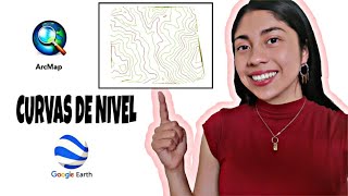
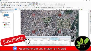
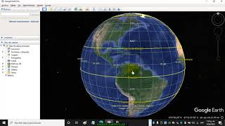
Georreferenciar una imagen satelital de Google Earth en Arcgis

En este vídeo te enseño como georreferenciar una imagen satelital de Google Earth en arcgis, este vídeo puede ser de utilidad para ti #arcgis #sig #GoogleEarth
Agradezco tu apoyo para seguir compartiendo contenido gratuito: https://www.paypal.me/laurarojasingen...
Sígueme en: Instagram: @ingelaura_
@amantesdelabiodiversidad
Links para más Información acerca de las capacitaciones de la Escuela Ambiental Gis:
Grupo WhatsApp: https://chat.whatsapp.com/HvbYEmtWhy6
Grupo Telegram: https://t.me/+dQJm9vpKToyZjEx
Análisis Multivariado para Estudios Ambientales con R https://hotm.art/CursoAnalisisMulti...
METODOS AVANZADOS EN ECOLOGÍA CON R https://hotm.art/Cursometodosavanza...
Diseños Experimentales Avanzados con R Steven Ricardo Mora Gonzalez https://hotm.art/tFKMeY
Modelado de Nicho Ecológico con R y Maxent https://hotm.art/CursoModeladoNicho...
Profesional en SIG y Medio Ambiente https://hotm.art/CursoProfesionalen...
Suscríbete a mi canal déjame tu comentario, muchas gracias por estar aquí